|
| |
| |
|
Flagstaff Lava River
Cave
Lava Tubes - Northern AZ |
|
| |
|
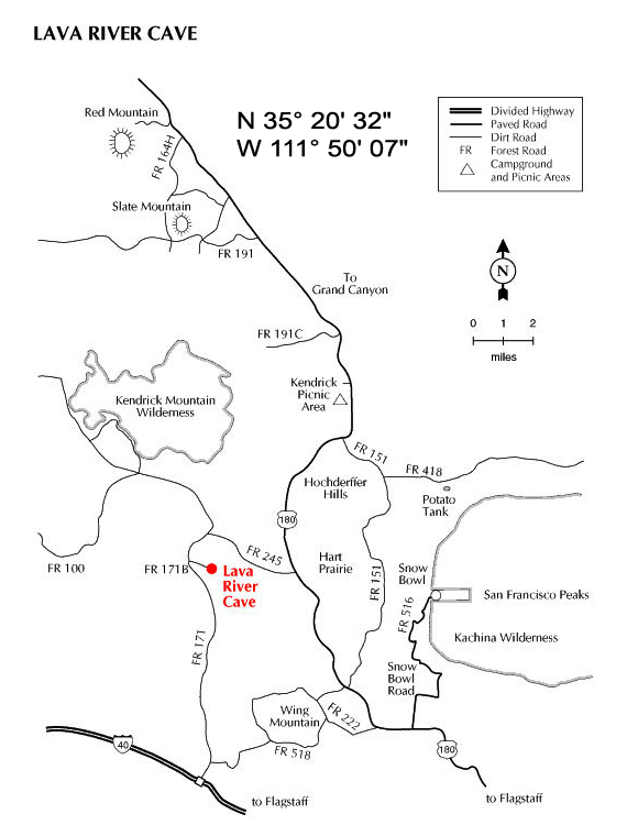
GPS Coordinates: |
N 35° 20' 32"
W 111° 50' 07" |
|
|
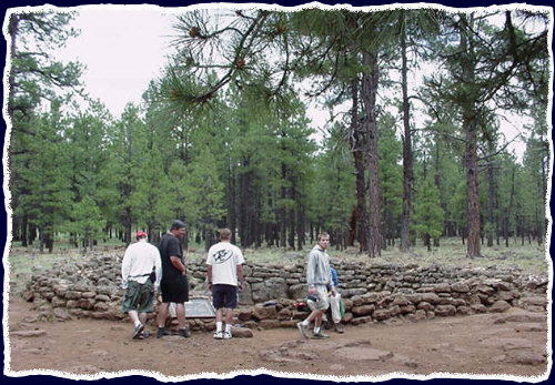
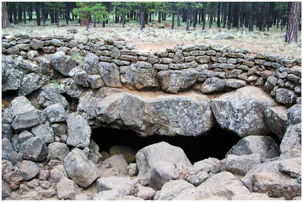
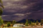
Approximately nineteen miles (+/- 45 minutes) from city hall in downtown Flagstaff, AZ, the lava river tube is an unusual cave in that the entry is a great hole in the ground and not a great (door) opening like other caves.
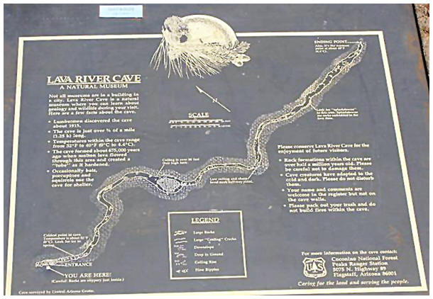
The cave is about 3/4 mile long and there is only one way in and one way out.
There are man-made steps out of lava rocks for visitors to enter, so entrance is not as hard as it may seem |
| |
|
Be sure to consider the following:
- No facilities for 15+ miles in every direction (40+ mins away)
- No rest rooms
- No food service
- No gas stations
- No medical help
- No cell phone reception
- Some rocks are sharp and slippery
- Operated by the Flagstaff Ranger District - (928) 526-0866
- Open year-round (expect snow in winter)
- Travel time from Flagstaff approx. 45 minutes
- Dirt road access
- Overnight camping permitted beginning 1 mile away from cave
- Difficulty level: Easy to intermediate
- Please pack out everything you pack in (no trash cans)
- Limited parking
- There is only one way in and one way out
- The cave is roughly 3/4 of a mile long and
will take the average group about 20-30 minutes to get to the end (60 minutes
round trip without stopping)
- Expect to duck in some parts of the cave
- Pets are to be on a leash at all times
- No wheel chair access
- Report anyone defacing the cave immediately - (928) 526-0866
- Coconino County National Forest official web page
Checklist:
- Flashlight for everyone going + one extra (just in case)
- Closed hard-sole sturdy shoes for everyone (no sandals)
- Water (not soda, coffee, alcohol--water!)
- Warm clothes (35° to 45° Fahrenheit inside cave year round)
- Sturdy shoes
- Plenty of gas in vehicle
- Travel food
- Camera
Directions to the Flagstaff
Lava River Cave
(Lava Tubes):
From Interstate
17
- Take the Milton Rd. Exit North (toward peaks). Follow signs
to Hwy 180.
- Turn North toward peaks (which is left) on Humphreys St.
- Then follow the directions below titled "From downtown."
From Interstate
40
- Take the E. Butler Ave. Exit and turn West.
- Turn right (North toward the peaks) on San Francisco St.
- Turn left (West) on Route 66 (a.k.a. W. Santa Fe Avenue).
- Then follow the directions below titled
"From downtown."
From Route
66
- Take route 66 toward the Flagstaff downtown area
- Then follow
the directions below titled "From downtown."
From downtown
- GPS Coordinates for the parking lot of the Flagstaff Lava Tubes
- Head North (toward the peaks) on "Humphreys St." (which is Hwy. 180).
- Take Humphreys St. almost to the end and turn left at "Fort Valley Rd." to stay on HWY 180. NOTE: If you turn left, it's "Fort Valley Rd. If you turn right, it's W. Columbus Ave. You'll be heading toward the Grand Canyon (keep your eyes pealed for the signs).
- Take "Fort Valley Rd." approximately 13.7 miles to 100 feet just past mile marker number "230."
- At this point, set your vehicle's odometer to zero (You will refer to this spot as your point of reference later).
- Turn left at forest service road (fire road) #245.
- Take that dirt road (which is regularly maintained in non-winter months) for
2.8 miles.
- Then, make a left at the end of the road (the "T"). Take that dirt road for 1.1 miles.
- When your odometer reads 3.9 miles from the point of reference, turn left (you should see a sign - as of Winter 2004).
- Take this road for 0.2 of a mile to the parking spots where your final odometer reading should be 4.1 miles from Hwy 180 (the point of reference).
|
| |
|