
 The San Francisco Peaks from Cherry Hill © 2009 C. Czach HIdalgo |
Lava
River
Cave
(The Lava Tubes)
Flagstaff, Arizona
GPS Coordinates for the parking lot of the Flagstaff Lava Tubes: N 35° 20' 32" Click here for important information.
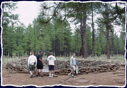
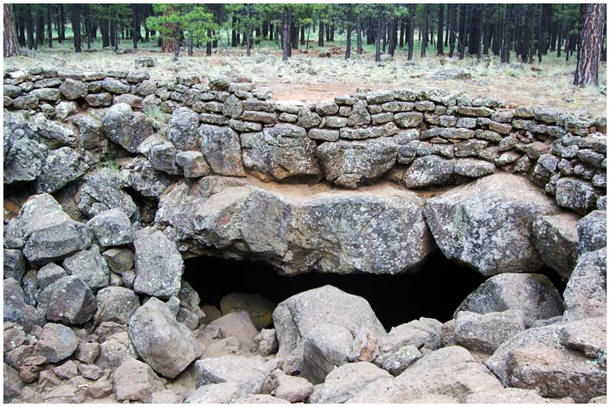
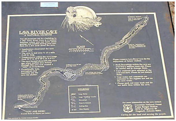
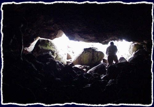
Approximately nineteen miles (40 minutes+) from city hall in downtown Flagstaff, AZ, the lava river tube is an unusual cave in that the entry is a great hole in the ground and not a great (door) opening like other caves. The cave is about 3/4 mile long and there is only one way in and one way out. There are man-made steps out of lava rocks for visitors to enter, so entrance is not as hard as it may seem.
Click Here and then refresh your mobile browser to view the most recent webcam image (above). Consider the following:
Checklist:
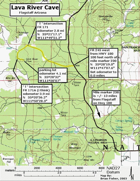
Directions to the Flagstaff Lava River Tubes (Cave):
From Interstate 17 Follow signs to Hwy 180. Turn North toward the peaks on Humphreys St. Then follow the directions below titled "From downtown."
From Interstate 40 At San Francisco St. turn North (toward the peaks). Turn West (which is left) on Route 66 (a.k.a. W. Santa Fe Avenue). Then follow the directions below titled "From downtown."
From Route 66 Then follow the directions below titled "From downtown."
From downtown Take Humphreys St. almost to the end and turn left at "Fort Valley Rd." to stay on HWY 180. NOTE: If you turn left, it's "Fort Valley Rd. If you turn right, it's W. Columbus Ave. You'll be heading toward the Grand Canyon (keep your eyes pealed for the signs). Take "Fort Valley Rd." approximately 13.7 miles to 100 feet just past mile marker number "230." At this point, set your vehicle's odometer to zero (You will refer to this spot as your point of reference later). Turn left at forest service road (fire road) #245. Take that dirt road (which is regularly maintained in non-winter months) for 2.8 miles. Then, make a left at the end of the road (the "T"). Take that dirt road for 1.1 miles When your odometer reads 3.9 miles from the point of reference, turn left. (you should see a sign - as of Winter 2004). Take this road for 0.2 of a mile to the parking spots where your final odometer reading should be 4.1 miles from Hwy 180 (the point of reference).
QR CODE Have your friends, family and other loved ones scan the QR Code below so they can view this page as well:
|
||||||||||||||||||||||||||||||||||||||||||||||||

